eclipsi.info
The sky, from your exact spot.
The starting point
A totality map shows where the shadow will travel, but not what matters on August 12: what will I actually see from this exact spot? The Sun will be very low, so a ridge, mountain or building may shorten or completely hide the key moment.
eclipsi.info was built to answer that question with a free public tool designed for a phone.
What we built
From a general map to real terrain. Pick any point and the app combines its position, elevation and horizon profile to calculate which phases remain visible above the landscape.
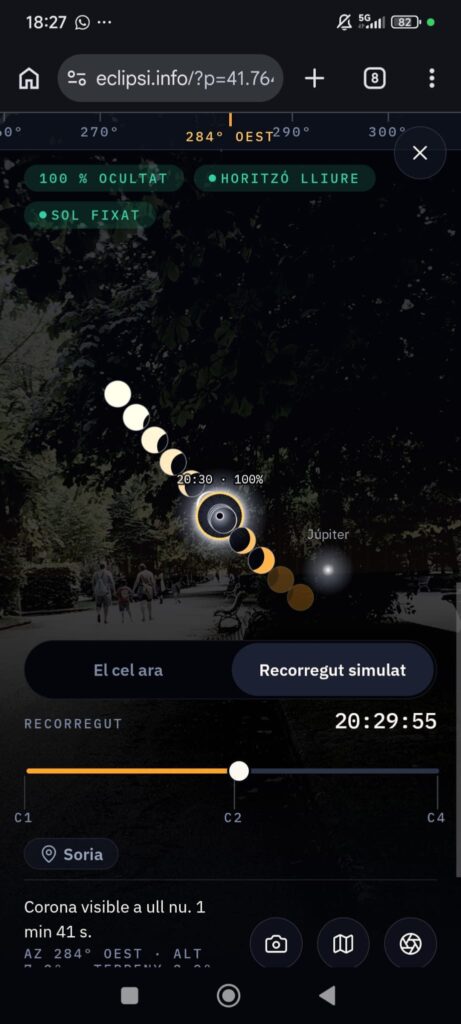
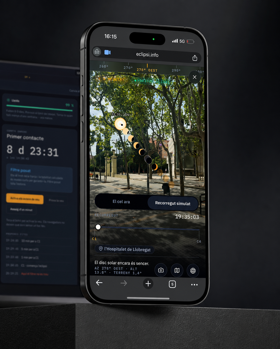
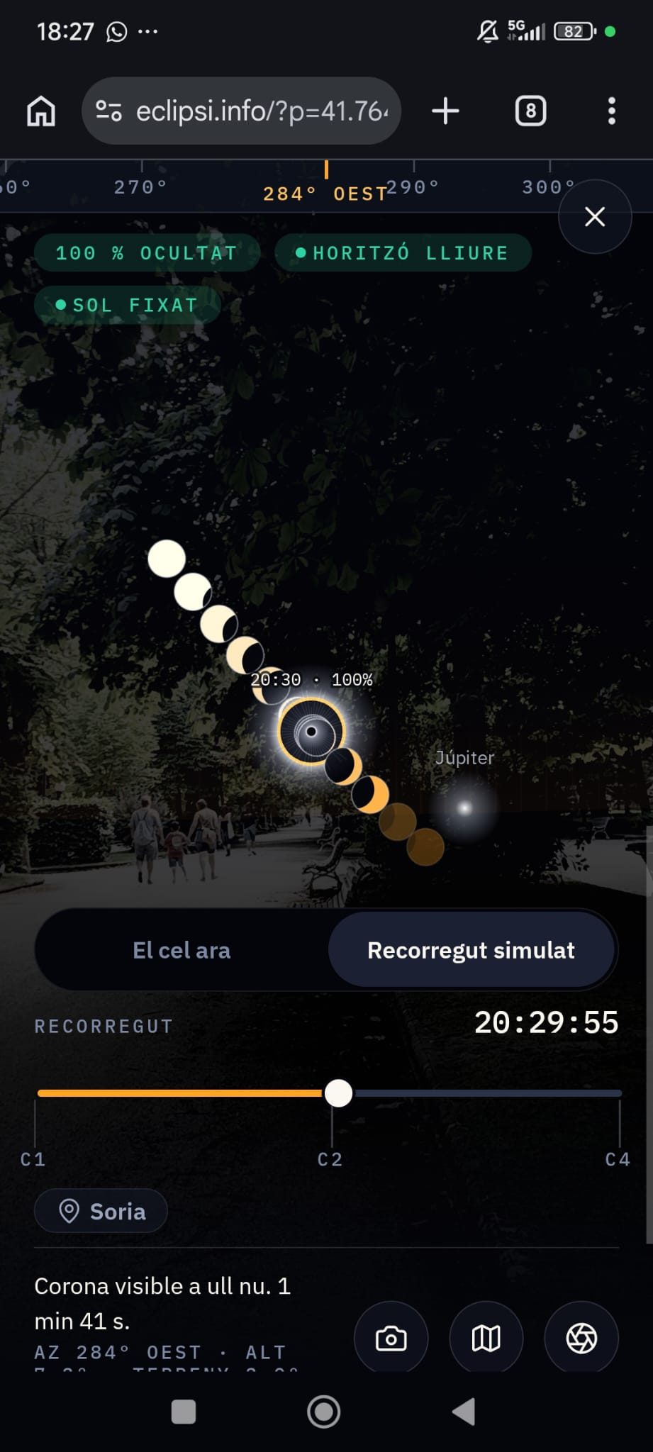
A camera that shows where to look. The path of the Sun and every eclipse phase are overlaid on the real view, revealing whether an obstacle will get in the way.
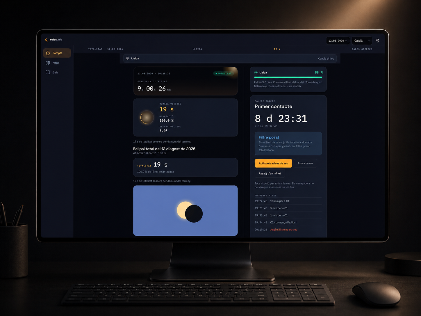
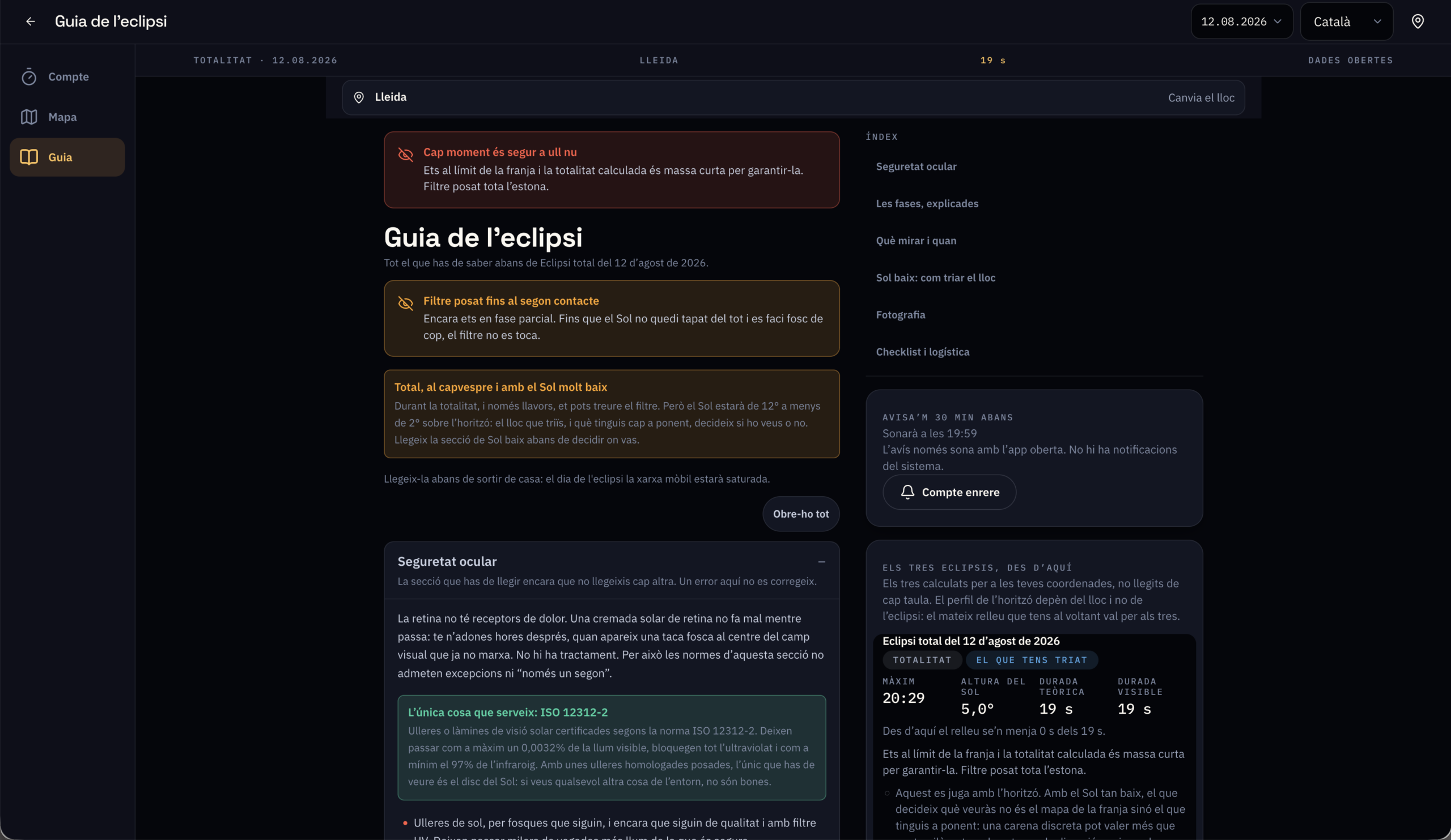
Useful information at the right moment. Minute-by-minute simulation, countdown, voice alerts, location comparison, cloud forecasts and conservative eye-safety guidance all live in one place.
Private and resilient. Calculations happen on the device, with no account, ads or tracking. The PWA can be installed in advance and keeps essential data available with poor coverage.
The terrain changes what you see.
The challenge was not displaying more data. It was turning astronomy, terrain and eye safety into a simple decision. The interface always answers three questions: where to stand, where to look and for how long.
The project in numbers
The impact · 2–13 August 2026
The tool went live on 2 August with 88 visitors. Ten days later, on eclipse day, it served 50,899 unique visitors and 2,975,142 requests. There was no paid campaign: the coverage came because the tool answered a question no other source did.
See the data as a table
| Day | Unique (CF) | Users (GA4) | GA4 coverage | Pages (CF) | Pages (GA4) | Requests |
|---|---|---|---|---|---|---|
| 2 | 88 | — | — | 132 | — | 1,023 |
| 3 | 220 | — | — | 1,512 | — | 6,791 |
| 4 | 12,054 | 2,191 | 18.2 % | 52,195 | 8,180 | 348,240 |
| 5 | 6,798 | 2,012 | 29.6 % | 37,638 | 10,085 | 213,153 |
| 6 | 7,521 | 2,374 | 31.6 % | 42,376 | 12,229 | 246,895 |
| 7 | 8,765 | 3,167 | 36.1 % | 107,934 | 18,191 | 536,589 |
| 8 | 11,272 | 3,637 | 32.3 % | 159,003 | 20,841 | 692,421 |
| 9 | 13,536 | 4,629 | 34.2 % | 171,478 | 26,934 | 756,213 |
| 10 | 18,084 | 5,938 | 32.8 % | 241,686 | 42,875 | 1,000,502 |
| 11 | 26,671 | 8,931 | 33.5 % | 391,199 | 63,730 | 1,546,057 |
| 12 | 50,899 | 16,633 | 32.7 % | 890,866 | 95,711 | 2,975,142 |
| 13 · partial | 3,347 | 540 | 16.1 % | 22,262 | 2,007 | 59,889 |
On the day itself the curve tells the story better than any total: it climbs all afternoon, peaks at 570,865 requests between 19:00 and 20:00 — about 158 per second — and collapses 95% within two hours. People checked the site until the last moment, then left the screen to look at the sky. The infrastructure held the peak with 666 server errors across 8.3 million requests (0.008%).
See the data as a table
| Hour | Requests |
|---|---|
| 02:00 | 9,784 |
| 03:00 | 3,776 |
| 04:00 | 3,970 |
| 05:00 | 4,635 |
| 06:00 | 11,918 |
| 07:00 | 34,540 |
| 08:00 | 77,449 |
| 09:00 | 106,766 |
| 10:00 | 121,906 |
| 11:00 | 139,783 |
| 12:00 | 144,016 |
| 13:00 | 154,697 |
| 14:00 | 178,118 |
| 15:00 | 205,904 |
| 16:00 | 242,815 |
| 17:00 | 285,719 |
| 18:00 | 420,745 |
| 19:00 | 570,865 |
| 20:00 | 171,640 |
| 21:00 | 29,424 |
| 22:00 | 23,994 |
| 23:00 | 16,713 |
| 00:00 · 13 | 10,273 |
| 01:00 · 13 | 5,692 |
| 02:00 · 13 | 6,261 |
The clipping adds up to 29 publications in Catalan, Spanish and French, from Time Out and Ouest-France to local radio. Only 16 left attributable clicks: audio pieces leave no link, and several written pieces quoted the address as plain text. The numbers below are the floor of each outlet’s impact, never the ceiling.
| Outlet | Format | Sessions | |
|---|---|---|---|
| Large audience | |||
| Time Out Barcelona · ES | Written | 11,397 | |
| Time Out Barcelona · CA | Written | 4,490 | |
| El Periódico | Written | 713 | |
| Ouest-France | Written | 191 | |
| Cadena SER | Audio | — | no measurable link |
| RAC1 | Audio | — | no measurable link |
| Regional and specialist | |||
| Diari de Tarragona | Written | 900 | |
| Regió7 | Written | 341 | |
| Diari de Barcelona | Written | 2 | |
| MetaData | Written | — | no measurable link |
| La Verdad | Written | — | no measurable link |
| Lleida.com | Written | — | no measurable link |
| La Xarxa | Audio | — | no measurable link |
| Local | |||
| Igualada News | Written | 175 | |
| Ràdio Cambrils | Audio | 25 | |
| Esplugues.digital | Written | 19 | |
| El 3 de Vuit | Written | 16 | |
| Ràdio Sant Andreu | Audio | 13 | |
| Vilapress | Written | — | no measurable link |
| Next Llobregat | Written | — | no measurable link |
| Viu Molins de Rei | Written | — | no measurable link |
| Ràdio Desvern | Audio | — | no measurable link |
| Ràdio Maricel | Audio | — | no measurable link |
| Outside the initial list | |||
| VilaWeb Press page | Written | 166 | |
| dBalears Press page | Written | 96 | |
| La Ciutat Press page | Written | — | no measurable link |
| Diari de Catalunya Press page | Written | — | no measurable link |
| Tarragona21 Analytics only | Written | 25 | |
| Rêves d'Espace Analytics only | Written | 2 | |
| 29 publications | 18,571 | ||
Sources: Cloudflare GraphQL Analytics (eclipsi.info zone) and Google Analytics 4. Data pulled on 13 August 2026.
How it went
Gallery · the project in pictures (click to enlarge)
"I wanted to know whether the eclipse would be visible from home. Maps showed the totality band, but not whether a mountain would block the Sun."Humbert Blanco · creator of eclipsi.info
Credits · the people behind it
Want a result like this for your project?